Malmo Maps and Orientation
(Malmo, Skane County, Sweden)
Sweden's third-biggest city, Malmo lies within the southerly region known as Scania. With a population of almost 300,000 residents in the city itself and more than 600,000 within the metropolitan area, Malmo was previously a mainly industrial town and has transformed its appearance towards the latter part of the 20th century, building many impressive modern buildings.
The heart of Malmo is the Old Town district, known is Swedish as the Gamla Staden. This part of the city is completely encircled by a historic canal and features three main public squares, the Gustav Adolfs Torg, the Lilla Torg and also the Stortorget.
Maps and Orientation of the City
Malmöhus Castle presides over the western side of the Gamla Staden, while to the north of Malmo and over the canal, you will find both the bus and railway stations, along with the coastline and harbour. On the southern side of the city, a maze of modern roads and streets are centred around the square named the Möllevangstorget, while some 8 km / 5 miles west of Malmo, the famous Oresund Bridge features a major motorway.
Maps of Malmo are available at the tourist office on the Stortorget and at the Centralstationen (railway station), and also at bookshops along the Södra Tullgatan and the Södergatan.
- Copenhagen (Denmark) - 47 km / 29 miles (50 minutes, west)
- Frederiksberg (Denmark) - 45 km / 28 miles (50 minutes, west)
- Hässleholm - 88 km / 55 miles (one hour and 20 minutes, north-east)
- Helsingborg - 65 km / 40 miles (one hour, north)
- Hörby - 53 km / 33 miles (50 minutes, north-east)
- Kävlinge - 30 km / 19 miles (35 minutes, north)
- Kristianstad - 96 km / 60 miles (one hour and 20 minutes, north-east)
- Lomma - 16 km / 10 miles (20 minutes, north)
- Lund - 20 km / 12 miles (23 minutes, north-east)
- Skurup - 38 km / 24 miles (40 minutes, south-west)
- Staffanstorp - 15 km / 9 miles (20 minutes, east)
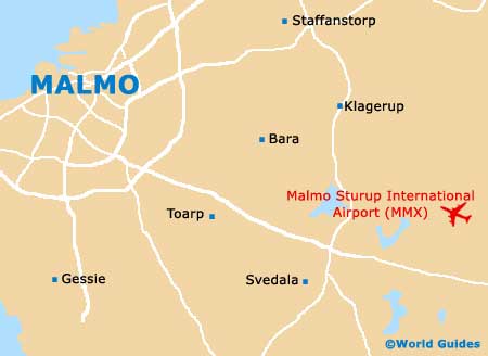
- Svedala - 20 km / 12 miles (25 minutes, south-east)
- Trelleborg - 32 km / 20 miles (35 minutes, south)
- Vellinge - 16 km / 10 miles (20 minutes, south)
- Ystad - 59 km / 37 miles (55 minutes, south-east)
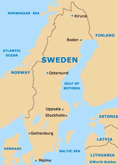
Map of Sweden
Map of Malmo